Mark Zander's Route Beta
(from 3/25/2006
hike/climb):
When walking into
the canyon there is a split. We took the right
fork of the split. There were many short
bouldering moves over chock stones and short
water falls. All of those could be protected by
spotting and a sitting belay. There might have
been one longer spot that took a cam or two.
At the end of
the canyon was an insurmountable pour off,
but I noticed a ramp to the left. I saw a
good crack and assumed I could protect it so
I started up. When I got up to the crack I
felt pretty run out already and put in a
cam. When I tested the cam it immediately
popped out due to the rotten rock. So I
continued to the top of the ramp without
gear rather than down climb. There was a
tree at the top that I used as an anchor and
belayed everyone up. I was worried that
seconds might pendulum if they fell off, but
no one fell off.
Length of
pitch - 70 feet? Difficulty - 5.5 or 5.6?
Free solo for leader, rock too rotten to
protect. Probably not worth the risk or
effort.
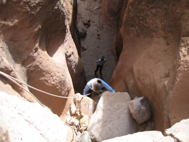
After getting
to the top we traversed over to the other
canyon and descended it. I remember
doing rappels but don't remember how long
they were. At least one of them may be 30+
feet?
Something to
try. Head up the left fork where the canyon
splits. It may be that it goes and is safer
than the ramp. Climb out and over to the
right fork. Rappel into the right fork, may
be a 50 foot? rappel.
Alternative is
to hike up each fork as far as possible and
then come back.
Sorry that I
can't remember the obstacles any better than
that.
Have fun, the
canyon resembles a Utah Canyon but it is
here in NM. It is fairly short hiking and
the best parts can be seen with little to no
climbing.
Gear - Have
everyone bring a seat harness and rappel
gear. Bring one rope 120+ ft? And a handful
of cams and large stoppers. Bring webbing to
leave for rappels.
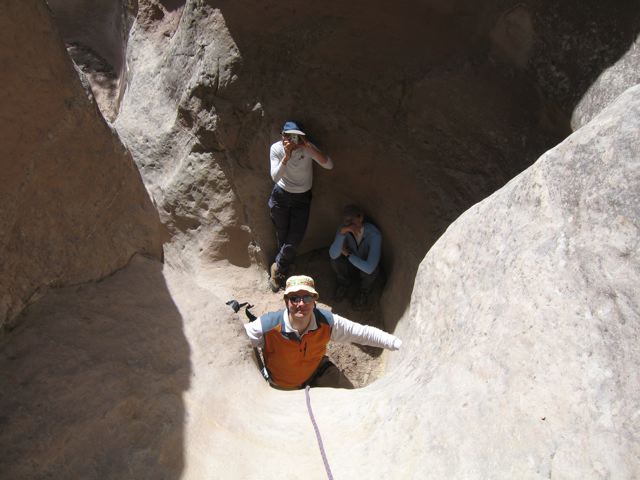
Rock quality
was crumbly and scary on ramp, but seemed
surprisingly much better on waterfalls.
However, a
very moderate and pleasant HIKE can be had
by most in the group without doing any
climbing at all. Only those that would enjoy
the scrambling need to do it. The canyon is
fun to see and easy to get to for everyone.
Francesco
Grilli's Comments, Photos, &
Route Map
(from 3/25/2006 hike/climb):
I agree on
Mark's remarks. I prepared a schematic map
of the hike, with reference to the pictures.
Click here
here for the map. Click
here for the photos described in my
map. Click
here
for my trip report.
I would
grade the ramp out a little lower, but it's
inclined (risk of pendulum, as Mark said, in
case of fall) and exposed, and the rock
quality is poor. See picture "Mark" on
the LAM website, but it looks easier there.
It's not worth, because the most beautiful
parts of the canyon are elsewhere.
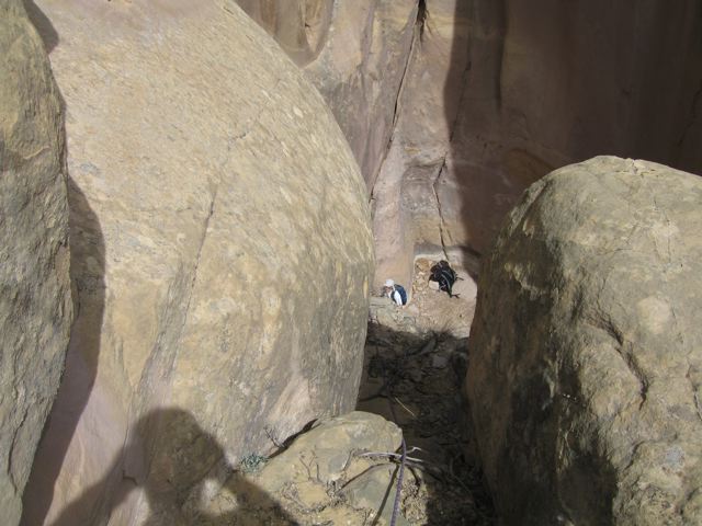
Hiking out
of the right branch offers nice views
(unstable terrain, but no problem).
The
rappelling down the pour-off at the
beginning of the left branch is optional,
but it's fun.
4/22/2008 Update,
Jan Studebaker's Photos & Comments
(from 4/20/2008
hike/climb):
Based on
the above comments and Francesco's
map, we took the right branch of the
canyon, climbed to the "end of the technical
part", and skipped some of the "unstable
terrain" by cutting straight across to the
top of the "insurmountable pour off", where
we did a 100 foot dead vertical rappel, and
continued down canyon for a final 50 foot
rappel (some of us continued to hike, but
came back to the final rappel to exit).
Note that by doing
the "insurmountable pour off" rappel we
missed the unpleasant "ramp out".
I used no
protection for the climbing, because either
I deemed it unnecessary, or it was nowhere
to be found. I highly recommend our
route, but bring plenty of webbing incase
you have to leave an anchor. My
photos illustrate our route.
This was a fine adventure!