Trip Leader
and Author:
Jean Dewart.
Participants:
Kathleen Gruetzmacher, Marilyn & Dave Yeamans, Dennis Brandt, Chris
Horley, David & Tevi Torney, Terry Morgan, Karl Fecht, and Jean
Dewart.
We had planned one of my favorite
late winter, early spring hikes - Ancho Canyon to Frijoles Canyon
hike for April 25th, using a car shuttle to bring hikers back to the
start.
We learned the week before our
scheduled hike, that the lower falls trail in Bandelier (the final
stretch of the hike in Frijoles Canyon of Bandelier Nat'l Monument)
was closed due to flooding from the spring runoff.
So, our group bandied about some
alternative hikes - and Dennis Brandt suggested - Ancho Canyon to
the Red Dot trail - since this preserved the idea of hiking along
the Rio, we chose this. We met at various places, and drove down to
the Ancho Rapid trail head. This is the trailhead on State Rte 4
south of White Rock that takes off on the mesa just to the north of
Ancho Canyon, along the old wagon road that the power lines follow.
We ran the car shuttle to the top of the Red Dot trail in Pajarito
Acres, and began the hike about 9 am.
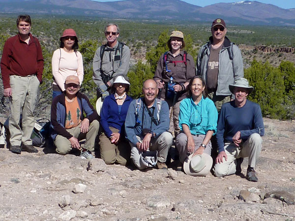
Our hearty gang.
Photo courtesy of Terry Morgan.
We arrived at the Rio Grande about
2 hours later - and received a spectacular view of the Rio Grande at
peak run-off for 2010 - 4500+ cfs. Ancho Rapid was big!!!
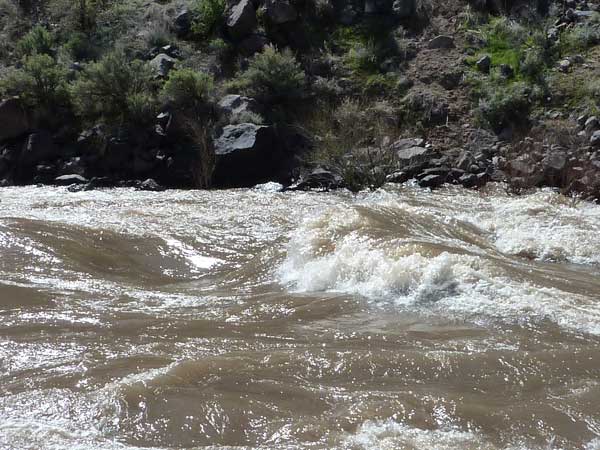
Ancho Rapids were.....well, rapid!
Photo courtesy of Terry Morgan.
We retraced our steps back up the
trail, away from the river, and in about 1/4 mile, we found the
large cairn, marking the river trail headed north towards the Red
Dot trail. The trail if fairly easy to follow, although in one or
two spots, feral cows have created some alternate routes.
It turned out to be a bit late in
the season for this hike....it was quite hot on the trail - probably
850F. We found shade beneath the junipers near the river
for lunch. The trip geologists, Terry, Dave, and Karl had fun
explaining the various features of White Rock Canyon that told of
its formation.
We had a very nice view of the
Water Canyon rapid - also pretty exciting in appearance.
We were lucky to have Dennis along
on the hike, as he is familiar with many of the pre-historic ruins
and petroglyphs in White Rock Canyon. Just south of where the river
trail meets the Red Dot trail, Dennis led us to a small set of ruins
and numerous petroglyphs.
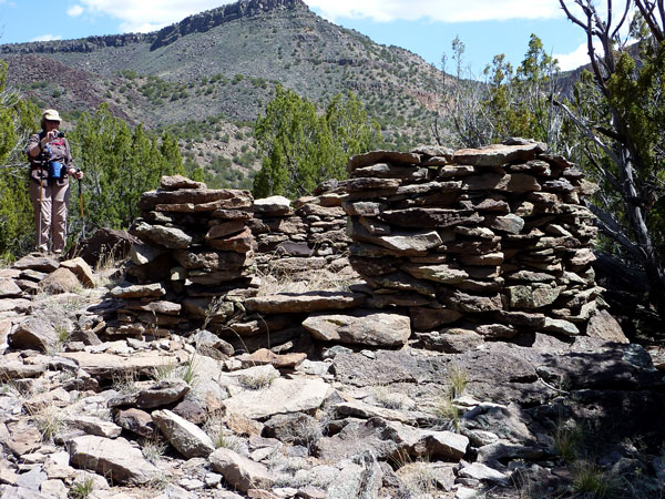
Dennis's wonderful
Indian ruins were a great surprise!
Photo courtesy of Terry Morgan.
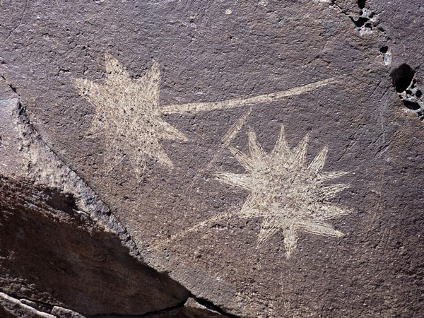
The amazingly
well preserved petroglyphs were abundant.
Photo courtesy of Terry Morgan.
We turned up the Red Dot trail at
about 3 pm, and arrived at the top of the canyon at our cars about 4
pm - in time for the PEEC 10th anniversary dinner and the LA Concert
performance.
Great hike, beautiful scenery in
the canyon and along the river - probably a bit nicer (cooler) in
early April.
