North Truchas
Peak Backpack, New Mexico
August 31 -
September 2, 2007
Participants: Tianshu Li and
Francesco Grilli
Photo Gallery: click
here for more North Truchas Peak photos
Route Description and Map: click
here. This otherwise useful trail guide contains distance
and elevation errors.
We left Los Alamos
at 7.30 am on Friday and arrived at the Santa Barbara Campground at
9, where we were welcomed by the campground host. He warned us about
a big black bull wandering around (which in fact crossed our path
soon thereafter) and asked us to spread the word that this year the
campground will be open until September 15th.
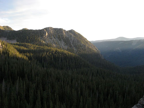
Morning-light
as seen from camp.
We followed the
West Fork of the Rio Santa Barbara; the trail is very well marked
and it has a gentle grade. Only the last part is a little steeper
and has switchbacks. Due to the abundant water flow, a couple of
crossing were quite tricky.
We set camp at No
Fish Lake, situated just below the Santa Barbara Divide. Apparently
the name of the lake is due to the absence of fish caused by
complete freezing in winter. The lake is situated a bit off trail
and there is no evident trail to get to it. In my opinion, the best
way to find it is to hike on the trail almost until the end of the
trees, spot it from above, and descend to the lake, rather than to
try a traverse in a forest characterized by numerous logs on the
ground.
The next morning we left camp at 6 am, reached the ridge of the
Santa Barbara Divide, and climbed directly to the summit of North
Truchas Peak. We reached the top in 1h40m. Even though the route to
the top didn't present any technical difficulty, the steepness of
the mountain and the high altitude required us to stop frequently.
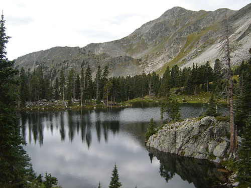
Truchas Lake with South Truchas Peak in the
background.
The peak offers
amazing views of the surroundings, especially of the other Truchas
Peaks.
We descended the SW
ridge until we encountered a saddle (some scrambling was required)
from which we reached the gorgeous Truchas Lakes. To my opinion,
together with Lake Katherine and Horseshoe Lake, these lakes offer
the best alpine lake landscape in the mountains of Northern New
Mexico.
From the lakes, we
went back to the saddle on the Santa Barbara Divide, and then back
to camp, just in time to avoid the rain of the usual afternoon
thunderstorm.
Lighting the
campfire with completely wet wood was a fun challenge. At camp we
were joined by a party of three.
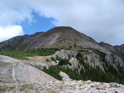
Truchas Peak as
viewed from the Santa Barbara Divide.
The next day we
packed our stuff and hiked back along the West Fork to the car.
I really like the
Pecos Wilderness, and especially the Truchas Peaks region for the
sense of wilderness, solitude, and also because the rugged shape of
the peaks reminds me of the Alps.
It was a wonderful
backpacking trip to conclude my three year stay in New Mexico.
