Author and Leader: Dave Scudder
Participants: Arnold Wise and
Dave Scudder
Original LAM Listing: click
here
The best efforts of
summer monsoon weather were unable to interfere with our trip up
Santa Barbara Canyon to the Truchas peaks Thursday, July 26 to
Sunday, July 29. Our trip dwindled to two participants due to
bad weather forecasts. Arnold, the other remaining adventurer, is an
orthopedist. I thought it fitting that my first backpack with
a new hip (replaced in October, 2006) should be shared with someone
who has, himself, performed hip replacements.
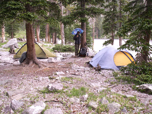
Hail in camp at
Truchas Lakes
Our departure right
after work and a fast food supper got us to the trailhead at Santa
Barbara Campground at 7:00 p.m. and to our first night's camp 2 1/2
miles up Santa Barbara Canyon by 8:00 p.m. Friday we started
up the West Fork of Santa Barbara Canyon by 8:00 a.m. Tracks
in the trail included some from a good sized bear. A beaver
dam stretched several hundred (!) feet across one stretch of the
stream. We completed the 13 miles and 3200' vertical from
Santa Barbara Campground to our base camp at Truchas Lakes at 3:30
Friday afternoon. Hail punctuated our afternoon, but the
evening was dry and serenaded by coyotes. There was only one
other party camped at Truchas Lakes.
Saturday morning we
left camp at 7:00 and hiked almost straight southwest toward South
Truchas. Crossing a ridge led us into another lovely cirque
where we were greeted by several young bighorn sheep. We chose
a promising green avalanche slope (what in winter would be couloir)
and picked our way straight up to the ridge just north of the peak.
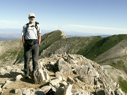
By 8:30 we were on top of South Truchas Peak, the highest of the
Truchas at 13,102'. In the west Redondo Peak seemed to tower
over both Los Alamos and Black Mesa in an illusion of parallax.
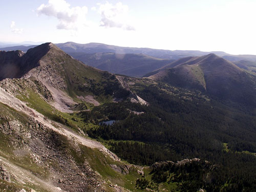
Middle Truchas from
South Truchas
The route from
South Truchas to Middle Truchas requires a modest drop and climb of
less than 300'. Because of this, purists don't count Middle Truchas
as a separate summit. As we gained our second destination at
13,066' on Middle Truchas by 10:00 a.m., clouds were already
beginning to collect over our heads.
North Truchas, Truchas Lakes, Chimayosos
From the top of
Middle Truchas we went down a ridge dropping toward the north into
the basin which is the source of the Rio Quemado. On the way
we met a group of about eight people coming up. The top of the
ridge was narrow and rocky, but not too scary. To get off of
it we had to scramble, climb and scree-glissade down a steep rocky
slope. Ideally we would have climbed out of the Rio Quemado
basin on a steep trail to a saddle just south of North Truchas Peak
and completed the trio. But as we reached the saddle at noon a
big black cloud hovered overhead. We resisted the temptation
to bag the last peak, ate our lunch, and returned down the east side
to camp.
By 4:30 the rain
had stopped. While Arnold fished I scrambled 45 minutes to the
top of North Truchas. On the way I met a group of bighorn
sheep with a frisky baby.
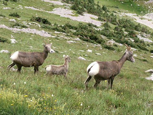
Truchas family
Sunday we had
plenty of sun to dry our gear before packing up. Then it
rained on us for most of our six hour hike out. The trip was
completed by a late lunch at Embudo Station.
