|
Back to "Monthly Program History"
August 19,
2009
"High-Altitude Geological Trekking in
Peru"
by Rick and Shari
Kelley
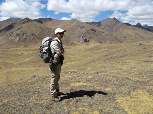
Nevado Ausangate
(elevation 6384 m) is a prominent landmark within view of the city of
Cuzco in the Eastern Cordillera of southeastern Peru. Geologic features
on and around the mountain, including young faulting associated with
destructive earthquakes, young volcanism, hot springs, and high
topographic relief, suggest that this massif may be actively forming and
creating substantial seismic risk to this part of Peru.
Reconnaissance scale mapping and sampling of the Ausangate area was
performed during a 12-day trek, on foot and on horseback, through the
high country surrounding the mountain.
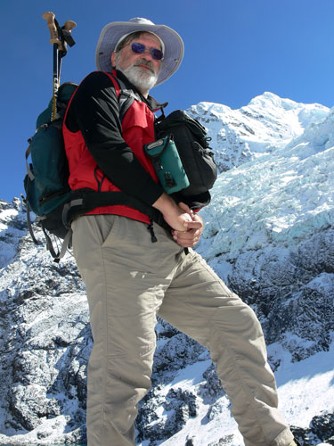
Rick standing under
glacier on Ausangate
In this presentation,
we will briefly report on the results of our reconnaissance scale
mapping of the Ausangate area. In addition, we will describe the
landscape of a remote region of Peru that has shaped (and been shaped
by) the indigenous culture in this area.
Shari Kelley is a Web
Information Specialist and Field Geologist with the New Mexico Bureau of
Geology and Mineral Resources, and an Adjunct Faculty in the Earth and
Environmental Science Department, at New Mexico Tech. She received
her B.S. from New Mexico State and her Ph.D. from Southern Methodist
University. Her research interests include application of apatite
fission-track thermochronology to tectonic and landscape evolution
problems in the High Plains-Rio Grande rift-Rocky Mountain-Colorado
Plateau region, and tectonic and landscape evolution of the Jemez
Mountains, New Mexico.
Shari ... 'out standing
in her field'......
Rick is a geologist and
geographical information systems (GIS) analyst in the Earth &
Environmental Sciences division at LANL. He earned his B.S. in
geology from New Mexico State in 1978. Rick’s geologic experience
includes oil and gas exploration, environmental geology, and
hydrogeology. For the last 12 years, Rick has specialized in
geologic applications in GIS.
Rick and Shari are both
avid hikers and backpackers, and have been LAM members for several
years.
|