Leader and Author:
Jan Studebaker.
Participants: Bill
Priedhorsky, Kathleen Gruetzmacher, Joe Ortega, Ron Morgan, and Jan
Studebaker.
Slideshow:
click
here. Current Point
Forecast: click
here. Getting There:
click
here.
Topo
Maps:
Online and
Polvadera Peak Quad
(10.3 MB).
I couldn't help but
notice beautiful Polvadera Peak on a
recent hike to Chicoma Mountain with Bill Priedhorsky and
friends. It's huge meadow looked like a wonderful place for
lunch, and none of us had climbed this relatively unknown mountain
in our own backyard. Polvadera Peak overlooks the Valles
Caldera National Preserve from the north, climbs to 11,217 feet
(3,418.94 meters), and is located at N 36.059742, W -106.404754.
Polvadera's closest neighbor is Chicoma, with Cerro Pedernal also
nearby.

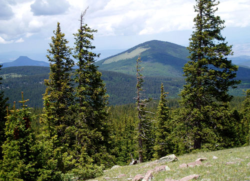
Polvadera Peak as seen from Chicoma Peak. Note the proximity
of Cerro Pedernal.
I researched the web
thoroughly, but found very little information on this seemingly
mysterious peak, except that geologists considered it one of the
best locations in the state for obsidian. I found no trip
reports, but did discover that Michael Di Rosa from LANL had led an
earlier trip to the peak by bushwhacking, on and off trail, from
Chicoma. Michael ascended via the south face of the peak.
After perusing several maps, I decided to access the mountain on
back roads from Abiquiu, and do the ascent from the north side.
If the dirt roads shown on Google Maps were accurate, we could
almost drive to the base for a 4 to 5 1/2 mile round trip hike with
a 2000' elevation gain....sounded pretty easy.

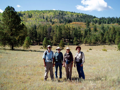
Bill, Joe, Kathleen, and Ron on the hike in; Jan is the
photographer.
As it turned out,
Google's road map was inaccurate but good enough to get us to a blocked
section of the road where we parked and began our longer and more
difficult than desired hike. If we were to walk the closed
road it would have been several miles longer than just hiking a due
south line of site, so we opted for the more direct bushwhack.
Since we were now starting the hike at about 8250' rather than the
hoped for 9200', we would also have to add 950 vertical feet to our
hike (not counting the ups and downs of the bushwhack itself).
The line of site bushwhack worked as predicted. The second
half of the hike in was through beautiful meadows and aspen forests,
sometimes on good game and bovine trails. When we reached the
base of the mountain we veered into a most unpleasant 'dead and
down' bushwhack for the remaining 2000 vertical feet. The
summit was marked by a cairn, with fleeting views of the valleys
below us.

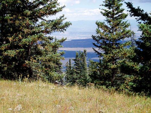
A
view from the summit of Polvadera Peak.
We had a much deserved
lunch break on the summit as the clouds and thunder began to roll
in. Although we had hoped to get to the huge meadow on the
south face, the way down to it looked to be harder than we wished,
considering the time, weather, and state of our energy depletion.
After two half-baked attempts at getting through the dense forest
and steep rock covered terrain, we opted to bail.
We decided to drop
down the north side of the peak (same side we came up), and try to
find the end of road that Google had shown on the map that had
turned out to be blocked. Although the road was not exactly as
shown, we did eventually get to our car; it was perhaps 5 miles
away....what a joyous moment it was to finally find the car! It did rain a
slight bit on us on the way
back, but we had great weather for the most part.

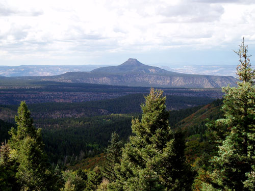
View of Cerro Pedernal on the descent of the north side of Polvadera
Peak.
Overall, we put in
a bit over 3000 vertical feet in perhaps 10 miles on our hike. Our
slideshow leaves out most of the bushwhacking, but certainly shows some
of the beauty we encountered.