Trachyte Creek Exploratory, Utah
October 6-14, 2007
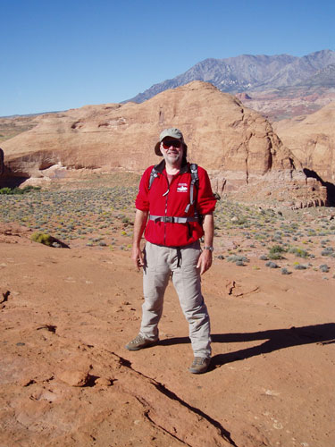
Author and Trip Leader:
Bill Priedhorsky
Photo
Galleries: Jan Studebaker, click
here, Dave
Gemeinhart, click
here.
Participants: Dave Chamberlin,
Jeri Sullivan, Dave Scudder, Carolyn Scudder, Bill Priedhorsky,
Allyn Pratt, Nellie Schachowskoj, Jackie Little, Karen Grace,
Kathleen Gruetzmacher, Jan Studebaker, Rick Light, Dave Gemeinhart
Why Trachyte?: It is the
tradition of the Mountaineers to spend a week in canyon country of
southern Utah in the spring and fall. This was the fall 2007 version
of this trip, and Bill’s 79th expedition to the canyons.
Trip leader Bill
Priedhorsky – still at it after all these years.
Our original plan was a
horse-supported drop camp in the narrows of Hall’s Creek Canyon,
north and west of Bullfrog, Utah. We had arranged our drop camp with
Bryan Brinkerhoff of Blind Bridle Outfitters (www.blindbridleoutfitters.com/),
and as of the evening before our departure, things were looking
fine. At 7:30 PM that Friday, Bryan informed me that the road from
Bullfrog to our trailhead had washed out in a flood, and the
earliest that we could go into the wilderness would be Tuesday. That
would take away too much of our vacation, and Bryan and I traded
several calls to options. We settled on Trachyte Canyon, which is
accessible from a trailhead on blacktop Utah Highway 276 and not as
vulnerable to flooding. In the end, we were all just as happy with
this destination as our original plan.
The place: I had last visited
Trachyte Creek in 1988 with the Mountaineers and 1994 with my son
Reid’s scout troop. It came to mind quickly as an alternate
destination, and was well worth a return trip thanks to its
isolation, slot canyons, and large expanses of slickrock.
Trachyte lies between the Henry
Mountains on the west and Lake Powell on the east. The Henrys are
hard rock igneous intrusions that reach 11,000 feet, smack in the
middle of the sandstone canyon country. Our guide Bryan was planning
to guide buffalo hunts in the Henrys after our trip – he claimed
that the Henrys held the only free-ranging buffalo herd in the lower
48.
The Henrys were a constant backdrop to
our adventures, marking the western horizon. They make a physical
mark on the Trachyte country, shedding hard rock boulders (including
the igneous rock, trachyte) that wash down through the sandstone,
carving slots and potholes along the way. Trachyte has a large
number of tributaries on both sides, but they are very different.
The west side canyons are clogged and carved by the Henry Mountain
hard rock, while the many east side canyons are more typical
sandstone country features.
We saw hardly a trace of human impact
in the canyon. The only people that we saw during our 7-day trip
were the highway traffic – people hauling boats to and from Lake
Powell – the day that we returned to the cars to pick up extra
propane.
Trachyte Creek is best accessed via
Trail Canyon. One can park just off the blacktop where Trail Canyon
goes under highway 276. The hike from Trail Canyon to Trachyte is
just 3 miles, but almost all the way is on cobbles, so it is not an
easy hike. Trail Canyon drops from an open drainage near the highway
to a deep, cool, damp narrows as one nears Trachyte.
Our camp was on the west side of
Trachyte Creek, in a grove of cottonwoods, about 200 yards
downstream from the confluence with Trail Canyon. Folks spread out
at least 100 yards up- and downstream from our kitchen tent.
Trachyte flowed clear and steadily during our visit. We filtered its
water for drinking, and boiled it straight out of the stream for
cooking and coffee.
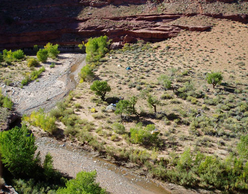
Our camp along
Trachyte Creek. Social activities centered on the kitchen,
to the right of the large tripod sun- and rain shelter (never used –
perfect weather!)
Our outings: We organized a
substantial day trip every day, including an outing to the outcrop
just above camp (see last photo) on our first afternoon in camp.
This was a physical trip with a lot of time on the trail. We
typically left camp at 10 AM, and returned between 4 and 6 PM. We
explored the side canyons to the east of Trachyte, spending some
time in about five of them, and even more time exploring the
slickrock between the canyons. Navigation across the slick rock was
not easy, because the slickrock had a very complex topography with
steep cliffs and canyons that break up the open slopes. We were
never able to reach the sandstone fingers on the eastern horizon,
which we believe overlook Hite. It was too far for a one day trip,
especially cutting across the grain of the canyons.
There were enough small pools in the
side canyons that we could take a bath every day. However, some
folks held out until their return to camp, where sun showers were
waiting. Two hikes of note were the Wednesday hike, when we thought
our propane was running short. We hiked up Trail Canyon to the cars,
drove a mile north on the highway to the northern branch of
Maidenwater Canyon, then followed it downstream to Trachyte. In
retrospect, I would not recommend entering Maidenwater via its
northern branch, because we ran into dense thickets. Instead, I
would suggest one of the two southern branches (just a little ways
south on the highway). The middle part of Maidenwater was a lovely
set of slots, with a mandatory jump from a chockrock into a pool.
However, we wearied in the lower, wet, muddy, poison ivy part of
Maidenwater, and were glad to return to camp.
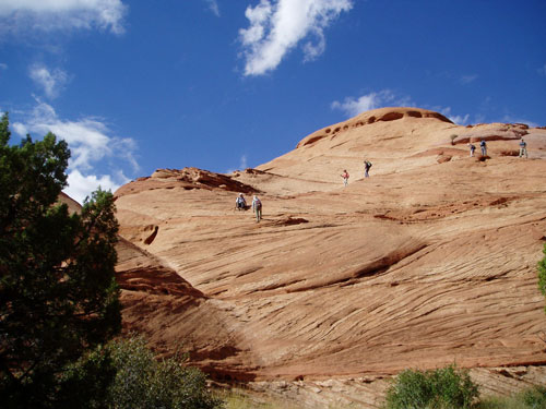
Hiking the slickrock
country east of camp
On our last full day, we hiked out of
Trachyte Canyon on the west side, a little downstream of camp,
crossed a small plateau, then dropped into Woodruff Creek (also a
good flow of water) and climbed the slickrock domes on its far side.
We dropped off the domes downstream from our ascent up the domes,
and followed a ledge above the stream until we found a cowboy trail
to the bottom, and another swim.
On our coming-out day, Saturday
October 13, we reached the cars at about lunchtime. Some of the
folks went back to Bullfrog to shower and clean up, and have a drink
in the restaurant with a view of Lake Powell, while several of us
explored a slot upstream (west) from highway 276, climbing one
chockstone after another. Dave S. thought that he saw a way out at
the top, but the sky was clouding and we were nervous to be in the
slots, so we hightailed our way out. The slots on the west side of
the highway are easily accessible and spectacular –at least two
branches of Maidenwater as well as Trail Canyon get very narrow.
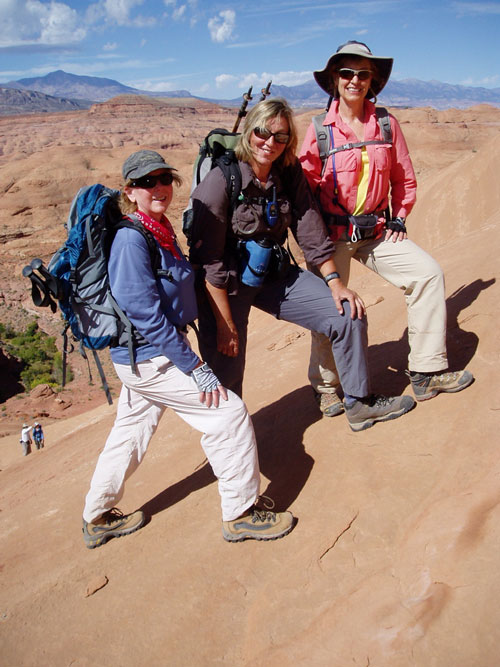
Jackie, Kathleen,
and Karen,
with the Henry Mountains behind and to the west.
Logistics, schedule, & costs:
We contracted with Bryan for 6 horses, each carrying up to 160
pounds, for the trip into Hall’s Creek Narrows. This would have been
a long trip for the packer – although our one-way hiking trip was 9
miles, the horses would have to go 20 miles each way from their
access point. The hike into Trachyte was much shorter, but still
hard, so we paid Bryan the originally agreed $2,000, plus a $300
tip. After allowance for community gear like tables and cooking
gear, the personal allowance for horse-packed gear was 67 pounds per
person. Bryan arrived with only 3 horses, and took our gear into
Trachyte in two trips; somehow, he was able to haul all our gear out
with 4 horses with a single trip, though our load was much lighter
after we ate our food and drank our wine.
On Saturday, October 6, we left Los
Alamos at about 6:30 AM, stopped for a snack at Bode’s, lunch in
Bluff, and maps (no luck) at the Natural Bridges visitor center, and
made the 4:00 ferry from Hall’s Crossing with about 20 minutes to
spare. The Trail Canyon hike to Trachyte took perhaps 2 hours.
We spent the Saturday nights before
and after the trip in the trailers (“family units”) at Bullfrog.
These units were comfortable enough; we rented 3 trailers, each of
which had 3 bedrooms and 2 bathrooms, for a total cost of just over
$500 per night. The trailers are equipped with new propane grills.
Dinner the last night was at the Anasazi Restaurant at the Defiance
House Lodge, and was quite good. Our lodging was booked at
http://lakepowell.com, and the restaurant menu can be found at
the same site.
All logistics in camp worked well,
with the exception of propane supplies. For the first time, we used
a propane, rather than a white gas, Coleman stove. It was extremely
easy to use, but, probably because many folks were cooking
substantial breakfasts, went through propane quickly. In retrospect,
we decided that we should bring 9 cylinders for a 6-night trip, and
ask folks who planned cooked breakfasts to bring another cylinder
each.
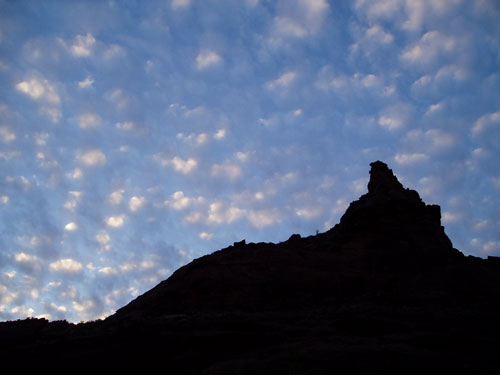
Sunset view from
camp.
The hardest part of a canyon trip is leaving, but we will be back.
